
Seguin River
Hydroelectric power generation has occurred on the Seguin River watershed since the late 1800’s. The existing Cascade Street GS has been in operation since 2017.
Hydroelectric power generation has occurred on the Seguin River watershed since the late 1800’s. The existing Cascade Street GS has been in operation since 2017.
Watershed Description
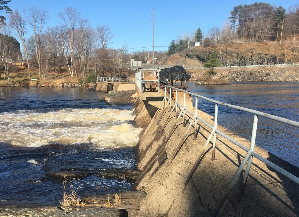
There are presently eleven water control structures within the Seguin River watershed.
Cascade Street Generating Station is the only waterpower facility on the watershed and is located near the mouth of the Seguin River flowing into Georgian Bay in the Town of Parry Sound. The watershed is a drainage area of 1034 km² with the headwaters on the western slopes of the Algonquin Dome near the hamlet of Whitehall, and flow westerly for a distance of approximately 40 km to Parry Sound Harbour at Parry Sound and ultimately to Georgian Bay.
Climate & Environment
• Watershed receives approximately 1,000 mm of annual precipitation – one of the wettest locations in Ontario
• Annual precipitation includes more than 300 cm of snowfall, typically representing about 25% of the annual wet precipitation amount
• Lake evaporation is an important consideration during extended dry periods in the summer when flows are reduced, compounding the reduction in lake levels
• Strategy of a longer duration of spring levels for fish and wildlife habitat and reproduction
• Gradual lake water level reduction throughout summer enhances base flow conditions and water quality in river reaches downstream of dams
• Provide for moderate seasonal and inter-annual variability in flows and levels; consideration for the natural flow regimes
• Flow augmentation to optimize flow over down-stream walleye spawning habitat
• Level fluctuations sensitivity for loon nesting
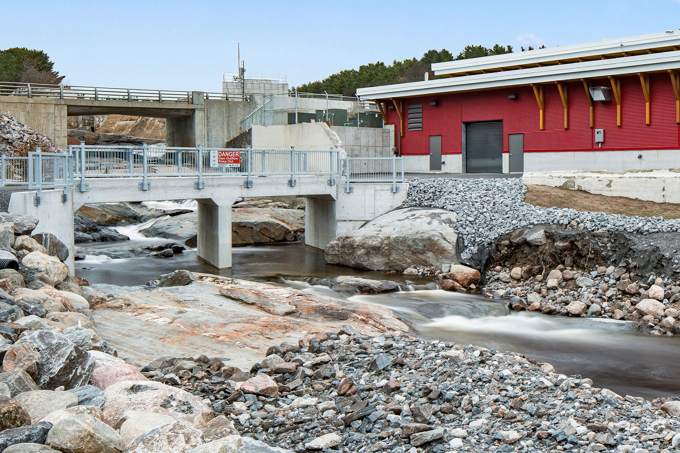
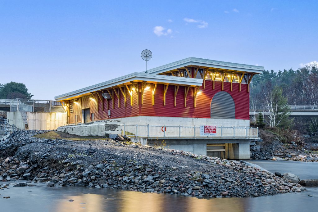
Cascade Street Generating Station
Watershed Location: This generating station / dam is located near the mouth of the Seguin River flowing into Georgian Bay in the Town of Parry Sound. It controls a drainage area of 1034 km².
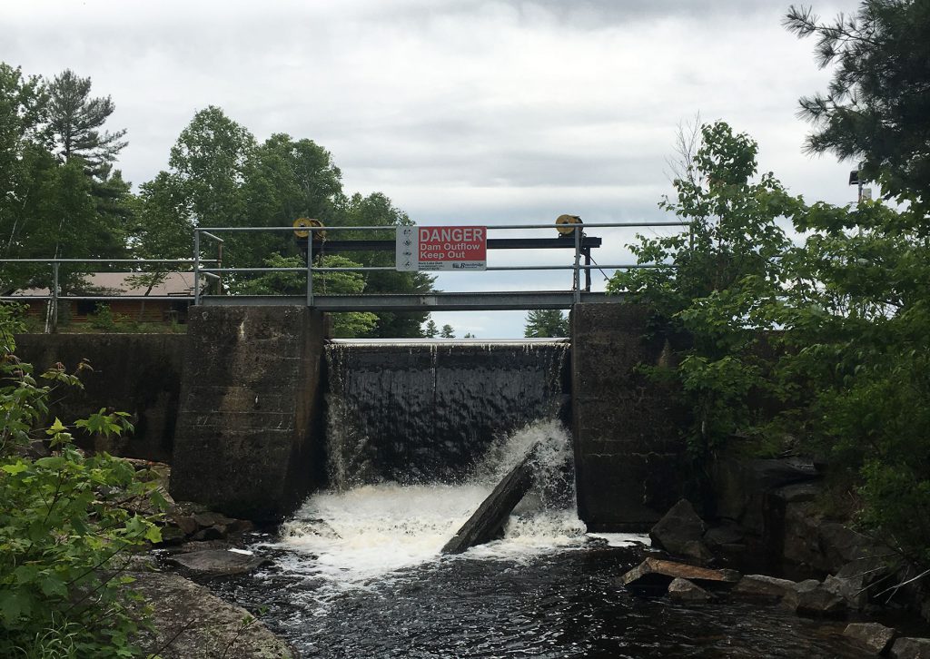
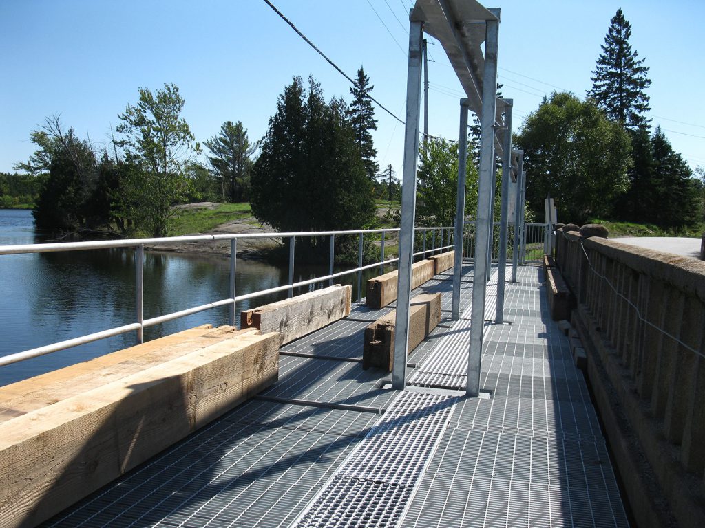
Structural Characteristics: The dam is made up of concrete with weirs, 4 stoplog spillways and 2 sluice gates.
In Service Date: Unit 1 – 2017
Capacity: 3.1 MW
History: In addition to his sawmills, Beatty had a grist mill built on the north side of the Sequin River, south of the Cascade Street Bridge: the same property that the present powerhouse occupies. In 1896 it was converted into Parry’s Sound’s first power plant. The mill was outfitted with two 75 kilowatt monocycle alternators which produced 2,300 volts at 60 hertz. These were installed in such a manner that they could be run by water power, or by steam when the river was being used for log driving by local lumber companies.
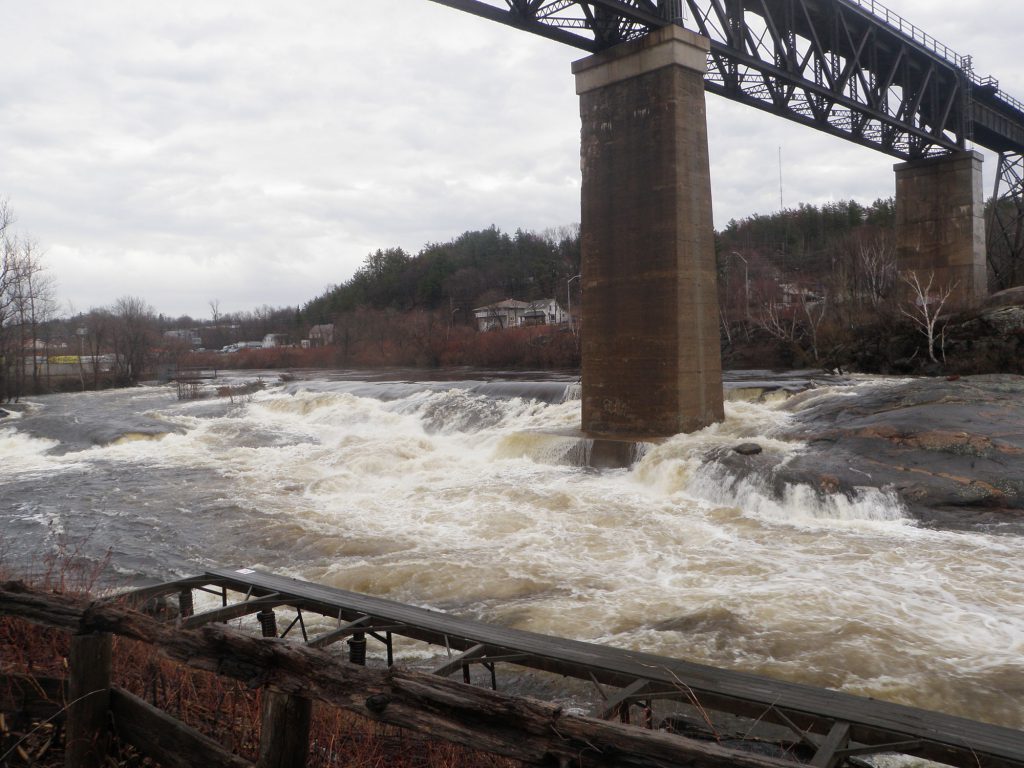
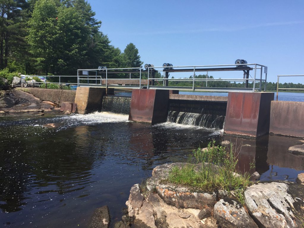
CPR Trestle Dam
Watershed Location: This dam is located at the mouth of the Seguin River flowing into Georgian Bay in the Town of Parry Sound. It controls a drainage area of 1040 km².
Structural Characteristics: The dam is made up of 3 concrete weirs with 2 stoplog spillways.
Fry’s Lake Dam
Watershed Location: This dam is located in Monteith Township. It controls a drainage area of 119 km².
Structural Characteristics: The dam is made up of 2 stoplog spillways with overflow weir abutments to shore.
Grey Owl Lake Dam
Watershed Location: This dam is located in McKellar Township. It controls a drainage area of 41 km².
Structural Characteristics: The dam is made up of 1 stoplog spillway with overflow weir abutments to shore.
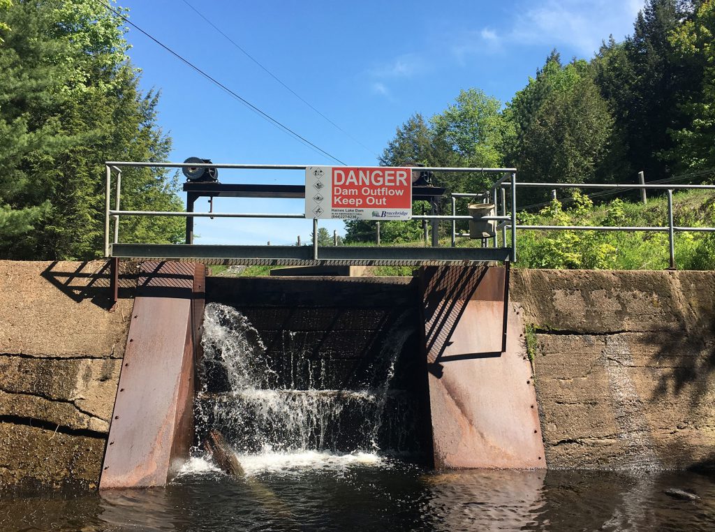
Haines Lake Dam
Watershed Location: This dam is located in McDougall Township. It controls a drainage area of 41 km².
Structural Characteristics: The dam is made up of 1 stoplog spillway with overflow weir abutments to shore.
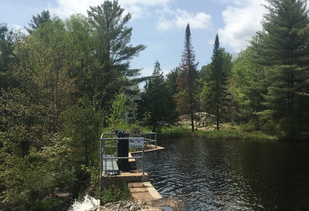
Harris Lake Dam
Watershed Location: This dam is located in Ferguson Township. It controls a drainage area of 26 km².
Structural Characteristics: The dam is made up of 1 stoplog spillway with overflow weir abutments to shore.
Horn Lake Dam
Watershed Location: This dam is located in Monteith Township. It controls a drainage area of 40 km².
Structural Characteristics: The dam is made up of 1 stoplog spillway with overflow weir abutments to shore.
Hurdville Dam
Watershed Location: This dam is located in McKellar Township. It controls a drainage area of 411 km² and Manitouwabing Lake.
Structural Characteristics: The dam is made up of 4 stoplog spillways.
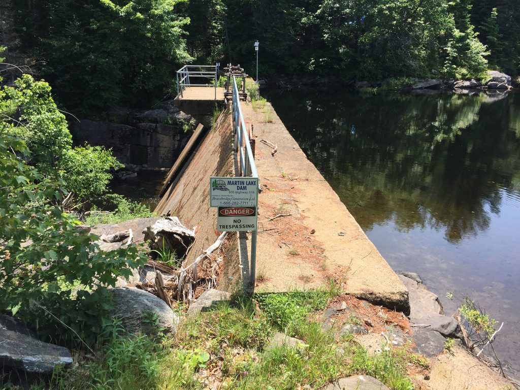
Martin Lake Dam
Watershed Location: This dam is located in Christie Township. It controls a drainage area of 24 km².
Structural Characteristics: The dam is made up of 1 stoplog spillway.
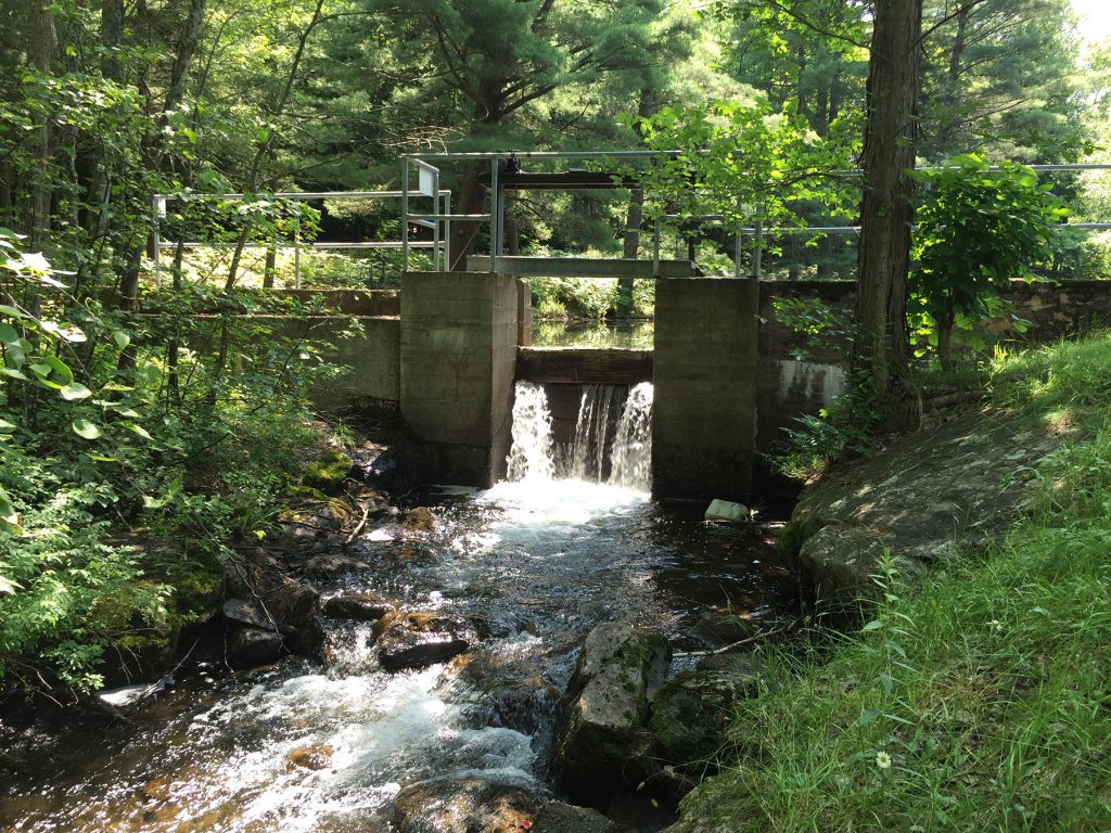
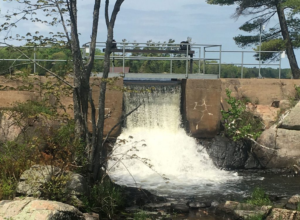
Mill Lake Dam
Watershed Location: This dam is located in the Town of Parry Sound. It controls a drainage area of 1029 km².
Structural Characteristics: The dam is made up of 4 stoplog spillways with overflow weirs.
Whitefish Lake Dam
Watershed Location: This dam is located in Humphrey Township. It controls a drainage area of 21 km².
Structural Characteristics: The dam is made up of 1 stoplog spillways with overflow weir abutments to shore.