
Gull River, Irondale River & Drag River
Watershed Description
The Gull River, Drag River and Irondale River are located in the Algonquin Highlands, Dysart et al, Minden Hills, Haliburton County.
The rivers are part of the Trent River and Lake Ontario drainage basins and flow from the southern Algonquin Provincial Park with the Gull River flowing to Balsam Lake, and the Drag River and Irondale River flowing into the Burnt River and Cameron Lake on the Trent-Severn Waterway (TSW). Bracebridge Generation has 3 generating stations in the watershed. Elliott Falls GS is located beside the TSW Elliott Falls Dam, Drag Lake GS is located beside the TSW Drag Lake Dam and Irondale GS is on the Irondale River.
Climate & Environment
• The Elliott Falls and Drag Lake dams are operated by the Trent Severn Waterway
• In 1902 the Raven Lake Portland Cement Company was formed, the original constructor of Elliott Falls GS
• In 1928 Ontario Hydro purchased Elliott Falls GS and mothballed it until it was redeveloped in 1990 to produce 800 kW
• Bracebridge Generation purchased Elliott Falls GS, Drag Lake GS and Irondale GS in 2016
• Drag Lake GS was built in 1925 and two new turbines were installed in 2008 producing up to 200 kW
• Irondale GS was built in 1995 and a new turbine was installed in 2009 and produces up to 450 kW
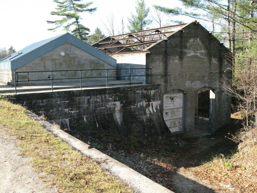
Elliott Falls Generating Station
Watershed Location: This dam is located on the Gull River in the Town of Norland. It controls a drainage area of 1264 km².
Structural Characteristics: The dam is owned and operated by the Trent Severn Waterway (TSW) with Bracebridge Generation owning the generating station. TSW controls the flows and levels through the site.
In Service Date: Unit 1 – 1989
Unit 2 – 1989
Capacity: 0.8 MW
History: The Elliott Falls waterpower generating station was built at the beginning of the century (est. 1904) to supply power to the old Raven Lake Portland Cement Company. The cement company ceased operations in 1914 but power was still produced for the surrounding area until 1928. In 1931 the plant was sold to Ontario Hydro but, in spite of many moves to reactivate it, it was never found to be economically viable. The plant was taken over by the Ministry of Natural Resources in the 1960’s. The hydropower site was leased to Elliott Falls Power Corporation and redeveloped within the confines of the old powerhouse structure in 1989. The generating station comprises two vertical semi-Kaplan turbines (variable pitch propellers with fixed guide vanes) connected to induction generators capable of generating 400 kW each. Bracebridge Generation acquired the station in 2016.
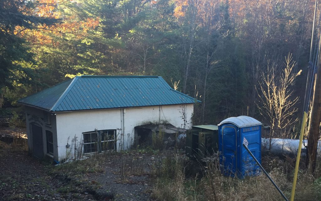
Irondale Generating Station
Watershed Location: This generating station is located on the Irondale River near the Town of Gooderham. It controls a drainage area of 251 km².
Structural Characteristics: There is a rock plug dam at this location and the generating station controls the upstream water level. An intake above the falls directs water through a rock tunnel to the turbine in the powerhouse.
In Service Date: Unit 1 – 1995
Capacity: 0.45 MW
History: The Irondale Generating Station was built in 1995 utilizing a horizontal francis turbine, gearbox and induction generator. In 2007 the turbine and generator were replaced with a vertical double regulated Kaplan and generator. Bracebridge Generation acquired the station in 2016.

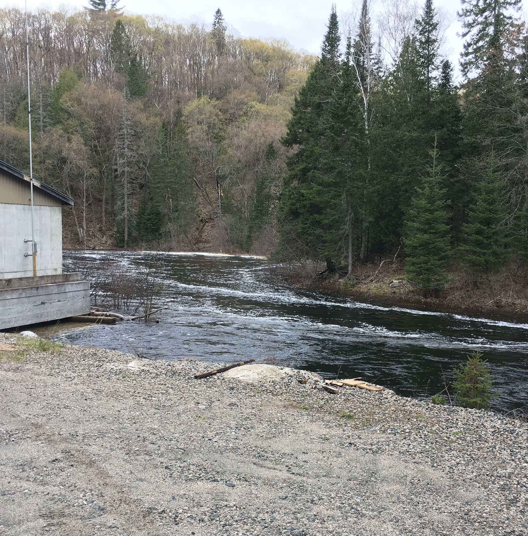
Drag Lake Generating Station
Watershed Location: This generating station is located on the Drag River near the Town of Haliburton. It controls a drainage area of 251 km².
Structural Characteristics: The dam is owned and operated by the Trent Severn Waterway (TSW) with Bracebridge Generation owning the generating station. TSW controls the flows and levels through the site.
In Service Date: Unit 1 – 2008
Unit 2 – 2008
Capacity: 0.288 MW
History: The Drag Lake Generating Station was originally built in 1925 utilizing a horizontal francis turbine and synchronous generator. In 2008 the turbine and generator were replaced with a pair of vertical double regulated Kaplans and induction generators. Bracebridge Generation acquired the station in 2016.